 VoGIS Metadatenkatalog
Basemap.at Vektortilecache
Vektortilecache zur Österreichischen Grundkarte basemap.at als in der Mapbox 2.0-Spezifikation“
Attributbeschreibung:
Die Vektor basemap.at wird derzeit in der Mapbox 2.0 Spezifikation angeboten. Der Vektor TileCache wird mit ESRI ArcGIS Pro generiert und wird derzeit in der Web Mercator Auxiliary Sphere (EPSG:3857) bereit gestellt. Ausgangsdaten und Aktualisierungszyklus entsprechen jenen der basemap.at Raster.
Simple
- Date (Publication)
- 2020-10-01
- Date (Revision)
- 2023-02-01T00:00:00
- Status
- On going
Point of contact
Vorarlberg, Landesamt für Vermessung und Geoinformation, Abteilung Geoinformation
+43 (0) 5522 / 754826
https://vorarlberg.at/-/landesamt-fuer-vermessung-und-geoinformation-l-1?article_id=122572
Johannitergasse 6
,
Feldkirch
,
6800
,
Austria
+43 (0) 5522 / 75482
+43 (0) 5522 / 754826
https://vorarlberg.at/-/landesamt-fuer-vermessung-und-geoinformation-l-1?article_id=122572
Publisher
Vorarlberg, Landesamt für Vermessung und Geoinformation, Abteilung Geoinformation
+43 (0) 5522 / 754826
https://vorarlberg.at/-/landesamt-fuer-vermessung-und-geoinformation-l-1?article_id=122572
Johannitergasse 6
,
Feldkirch
,
6800
,
Austria
+43 (0) 5522 / 75482
+43 (0) 5522 / 754826
https://vorarlberg.at/-/landesamt-fuer-vermessung-und-geoinformation-l-1?article_id=122572
Custodian
Vorarlberg, Landesamt für Vermessung und Geoinformation, Abteilung Geoinformation
+43 (0) 5522 / 754826
https://vorarlberg.at/-/landesamt-fuer-vermessung-und-geoinformation-l-1?article_id=122572
Johannitergasse 6
,
Feldkirch
,
6800
,
Austria
+43 (0) 5522 / 75482
+43 (0) 5522 / 754826
https://vorarlberg.at/-/landesamt-fuer-vermessung-und-geoinformation-l-1?article_id=122572
Owner
Vorarlberg, Landesamt für Vermessung und Geoinformation, Abteilung Geoinformation
+43 (0) 5522 / 754826
https://vorarlberg.at/-/landesamt-fuer-vermessung-und-geoinformation-l-1?article_id=122572
Johannitergasse 6
,
Feldkirch
,
6800
,
Austria
+43 (0) 5522 / 75482
+43 (0) 5522 / 754826
https://vorarlberg.at/-/landesamt-fuer-vermessung-und-geoinformation-l-1?article_id=122572
- Maintenance and update frequency
- Irregular
- Keywords
-
-
basemap.at
-
- Keywords
-
-
GEMET
-
-
planung
-
geographie
-
datensammlung
-
- Use constraints
- License
- Spatial representation type
- Vector
- Denominator
- 5000
- Metadata language
- Deutsch
- Character set
- UTF8
- Topic category
-
- Planning cadastre
N
S
E
W
))
- Unique resource identifier
- EPSG:3857
- Hierarchy level
- Service
- Statement
-
basemap.at Vektor wird im 2-Monats Zyklus auf Basis der bei den Partnern stets aktualisiert vorliegenden Geodaten für gesamt Österreich neu berechnet. Details siehe Homepage: www.basemap.at (Solange Status "Beta", erfolgt keine Aktualisierung!)
- File identifier
- ee9bf1a0-401c-4379-88ba-cbda656791be XML
- Metadata language
- Deutsch
- Character set
- UTF8
- Hierarchy level
- Dataset
- Date stamp
- 2025-04-14T15:00:13
- Metadata standard name
-
ISO 19115:2003/19139
- Metadata standard version
-
1.0
Point of contact
Vorarlberg, Landesamt für Vermessung und Geoinformation, Abteilung Geoinformation
+43 (0) 5522 / 754826
https://vorarlberg.at/-/landesamt-fuer-vermessung-und-geoinformation-l-1?article_id=122572
Johannitergasse 6
,
Feldkirch
,
6800
,
Austria
+43 (0) 5522 / 75482
+43 (0) 5522 / 754826
https://vorarlberg.at/-/landesamt-fuer-vermessung-und-geoinformation-l-1?article_id=122572
Overviews
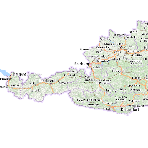
Basemap Vektor
Spatial extent
N
S
E
W
Provided by

Associated resources
Not available