 VoGIS Metadatenkatalog
WMS Waldfläche Vorarlberg
Darstellung der Waldfläche Vorarlberg 2005
Simple
Identification info
- Date (Creation)
- 2013-11-27T12:00:00
- Date (Revision)
- 2019-07-08T12:00:00
- Unique resource identifier
- daaa579e-1923-45ed-a8af-6744366183bf
Publisher
Vorarlberg, Landesamt für Vermessung und Geoinformation, Abteilung Geoinformation
+43 (0) 5522 / 754826
https://vorarlberg.at/-/landesamt-fuer-vermessung-und-geoinformation-l-1?article_id=122572
Johannitergasse 6
,
Feldkirch
,
6800
,
Austria
+43 (0) 5522 / 75482
+43 (0) 5522 / 754826
https://vorarlberg.at/-/landesamt-fuer-vermessung-und-geoinformation-l-1?article_id=122572
Owner
Vorarlberg, Landesamt für Vermessung und Geoinformation, Abteilung Geoinformation
+43 (0) 5522 / 754826
https://vorarlberg.at/-/landesamt-fuer-vermessung-und-geoinformation-l-1?article_id=122572
Johannitergasse 6
,
Feldkirch
,
6800
,
Austria
+43 (0) 5522 / 75482
+43 (0) 5522 / 754826
https://vorarlberg.at/-/landesamt-fuer-vermessung-und-geoinformation-l-1?article_id=122572
-
GEMET - INSPIRE themes, version 1.0
-
-
bewirtschaftungsgebiete/schutzgebiete/geregelte gebiete und berichterstattungseinheiten
-
-
GEMET
-
-
wald
-
waldbestand
-
- Keywords
-
-
wms
-
web map service
-
- Use constraints
- License
- Service Type
- OGC:WMS
- Service Version
-
1.3.0
- Fees
-
NONE
N
S
E
W
))
Coupled Resource
- Operation Name
-
GetCapabilities
- Identifier
-
a2bd957a-8e67-4610-af67-02a7ee81f178
- Coupling Type
- Tight
Contains Operations
- Operation Name
-
GetCapabilities
- Distributed Computing Platforms
- Web services
- Connect Point
- Format : image/png ( OGC:WMS-1.3.0-http-get-map )
Reference System Information
No information provided.
- Distribution format
-
-
WMS
(
1.3.0
)
-
WMS
(
1.3.0
)
- OnLine resource
- WMS Waldfläche ( OGC:WMS-http-get-capabilities )
- Hierarchy level
- Service
- File identifier
- daaa579e-1923-45ed-a8af-6744366183bf XML
- Metadata language
- Deutsch
- Character set
- UTF8
- Hierarchy level
- Service
- Hierarchy level name
-
Dienst
- Date stamp
- 2025-04-14T14:57:45
- Metadata standard name
-
ISO 19115:2003/19139
- Metadata standard version
-
1.0
Custodian
Vorarlberg, Landesamt für Vermessung und Geoinformation, Abteilung Geoinformation
+43 (0) 5522 / 754826
https://vorarlberg.at/-/landesamt-fuer-vermessung-und-geoinformation-l-1?article_id=122572
Johannitergasse 6
,
Feldkirch
,
6800
,
Austria
+43 (0) 5522 / 75482
+43 (0) 5522 / 754826
https://vorarlberg.at/-/landesamt-fuer-vermessung-und-geoinformation-l-1?article_id=122572
Overviews
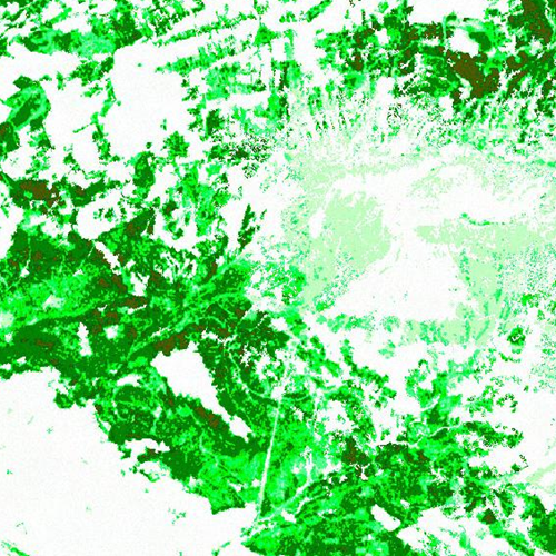
Waldfläche WMS
Spatial extent
N
S
E
W
Provided by

Associated resources
Not available