 VoGIS Metadatenkatalog
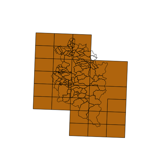
Blattschnitt Schweizer Karte (Fremddaten)
Polygonkarte mit dem Blattschnitt / Kartenschnitt / Blatteinteilung der Schweizer Landeskarte 1:25.000 das Vorarlberger Landesgebiet betreffend, mit Blattnummer und Blattname als Attribut.
Wichtige Felder und Datentypen der Attributtabelle:
BLS_25T_ID = Blattnummer (Int)
BLATT_NR = Blattnummer (Int)
BLATTNAME = Name des Blattes (Text)
Datenquelle: Blattschnitt_Schweiz_25000.shp
Simple
- Date (Creation)
- 2009-11-17
- Date (Revision)
- 2019-07-08T12:00:00
- Identifier
- 983eab5b-e9e2-4a74-9132-b5201babd84a
- Presentation form
- Digital map
- Status
- Completed
+43 (0) 5522 / 754826
https://vorarlberg.at/-/landesamt-fuer-vermessung-und-geoinformation-l-1?article_id=122572
+41 58 469 04 59
http://www.swisstopo.admin.ch/
+43 (0) 5522 / 754826
https://vorarlberg.at/-/landesamt-fuer-vermessung-und-geoinformation-l-1?article_id=122572
+43 (0) 5522 / 754826
https://vorarlberg.at/-/landesamt-fuer-vermessung-und-geoinformation-l-1?article_id=122572
- Maintenance and update frequency
- As needed
-
VOGIS-Thema
-
-
Blattschnitte
-
-
VOGIS-Unterthema
-
-
Blattschnitte
-
- Keywords
-
-
Blattschnitt
-
Blatteinteilung
-
Kartenschnitt
-
-
GEMET - INSPIRE themes, version 1.0
-
-
Geografische Gittersysteme
-
-
GEMET
-
-
Karte
-
- Use limitation
-
Nutzungsbestimmungen der Dateneigentümer
- Access constraints
- Copyright
- Spatial representation type
- Vector
- Denominator
- 10000
- Metadata language
-
ger
- Character set
- UTF8
- Topic category
-
- Planning cadastre
))
- Reference system identifier
- EPSG / MGI / Austria GK West (EPSG:31254) / 7.4
- Distribution format
-
-
ESRI Shapefile
(
1.0
)
-
ESRI Shapefile
(
1.0
)
Distributor
- Name
-
ESRI Shapefile
- Version
-
1.0
- OnLine resource
- Geoserver-WMS ( OGC:WMS-http-get-capabilities )
- OnLine resource
- Geoserver-WFS ( OGC:WFS-http-get-capabilities )
- OnLine resource
-
Shapefile-Download
(
WWW:DOWNLOAD-1.0-http--download
)
Achtung !! max. Features = 100.000
- OnLine resource
-
Geopackage-Download
(
WWW:DOWNLOAD-1.0-http--download
)
Achtung !! max. Features = 100.000
- Hierarchy level
- Dataset
- Statement
-
Auf exakten Koordinaten basierend
- File identifier
- 983eab5b-e9e2-4a74-9132-b5201babd84a XML
- Metadata language
-
ger
- Character set
- UTF8
- Hierarchy level
- Dataset
- Date stamp
- 2025-04-07T09:58:04
- Metadata standard name
-
ISO 19115:2003/19139
- Metadata standard version
-
1.0
+43 (0) 5522 / 754826
https://vorarlberg.at/-/landesamt-fuer-vermessung-und-geoinformation-l-1?article_id=122572
Overviews
Spatial extent
Provided by
