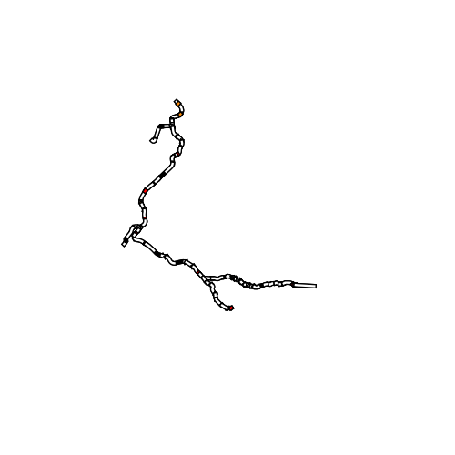
Intermodales Verkehrsreferenzsystem (GIP.at) Bahnlinien Vorarlberg
Öffentliche Bahnstrecken in Vorarlberg, welche sich in Besitz der ÖBB und der Montafonerbahn AG befinden. Die Bahnlinien wurde auf Basis des Luftbilds 2012 digitalisiert. Nicht enthalten sind die Privatbahnen "Rheinbähnle" und die "Wälderbahn". Die Informationen sind Teil der GIP.
Wichtige Felder und Datentypen der Attributtabelle:
BAHNLINIE1 (String) Grobe Einteilung der einzelnen Abschnitte des Netzes
ABSCHNITT (String) Beschreibung des jewiligen Abschnitts in Tunnel, Strecke, Bahnhof oder Haltestelle
NAME (String) Name der Haltestelle/des Bahnhofs
Datenquelle: bahnlinie.shp
Simple
- Date (Creation)
- 2009-09-11
- Date (Revision)
- 2019-07-08T12:00:00
- Identifier
- AT.0025.31.00 / 2d77b3dd-9040-47d2-b1ce-8b738a236984
- Presentation form
- Digital map
+43 (0) 5522 / 754826
https://vorarlberg.at/-/landesamt-fuer-vermessung-und-geoinformation-l-1?article_id=122572
+43 (0) 5522 / 754826
https://vorarlberg.at/-/landesamt-fuer-vermessung-und-geoinformation-l-1?article_id=122572
+43 (0) 5522 / 754826
https://vorarlberg.at/-/landesamt-fuer-vermessung-und-geoinformation-l-1?article_id=122572
+43 (0) 5522 / 754826
https://vorarlberg.at/-/landesamt-fuer-vermessung-und-geoinformation-l-1?article_id=122572
-
VOGIS-Thema
-
-
Verkehr
-
-
VOGIS-Unterthema
-
-
Bahn
-
- Keywords
-
-
Bahnlinie
-
Eisenbahn
-
Verkehrsnetze
-
Eisenbahnnetz
-
- Access constraints
- Copyright
- Denominator
- 5000
- Metadata language
- Deutsch
- Topic category
-
- Planning cadastre
))
- Reference system identifier
- EPSG / MGI / Austria GK West (EPSG:31254) / 7.9
- Distribution format
-
-
ESRI Shapefile
(
1.0
)
-
ESRI Shapefile
(
1.0
)
- OnLine resource
- Geoserver-WMS ( OGC:WMS-http-get-capabilities )
- OnLine resource
- Geoserver-WFS ( OGC:WFS-http-get-capabilities )
- OnLine resource
-
Shapefile-Download
(
WWW:DOWNLOAD-1.0-http--download
)
Achtung !! max. Features = 100.000
- OnLine resource
-
Geopackage-Download
(
WWW:DOWNLOAD-1.0-http--download
)
Achtung !! max. Features = 100.000
- Hierarchy level
- Dataset
- Statement
-
Digitalisierung auf Basis Luftbild und Grenzen des digitalen Katasters
- File identifier
- 2d77b3dd-9040-47d2-b1ce-8b738a236984 XML
- Metadata language
- Deutsch
- Hierarchy level
- Dataset
- Date stamp
- 2024-01-29T11:50:12
- Metadata standard name
-
ISO19115
- Metadata standard version
-
2003/Cor.1:2006
Overviews

Spatial extent
))
Provided by

 VoGIS Metadatenkatalog