 VoGIS Metadatenkatalog
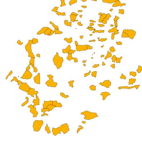
Geotopinventar Vorarlberg (Fremddaten)
Vom Physisch-Geographischen und Bodenkundlichen Institut der Universiät Amsterdam erstelltes Inventar welches vom Vorarlberger Landschaftspflegefonds in Auftrag gegeben wurde. Beinhalet 124 Objekte. Der Aufbau entspricht jedem des Biotopinventars. Die Abgrenzung sowie Auswahl eines Geotops erfolgte nach folgenden Kriterien: wissenschaftliche Bedeutung. Seltenheit, Attraktivität, historische Bedeutung und Ästhetik der Landschaft.
Wichtige Felder und Datentypen der Attributtabelle:
AREA (double) Fläche
NUMMER (string) Nummerierung des Gebiets (ebenfalls Einteilung in regionale Klassen)
NAME (string) Name des Gebiets
GTNUMMER (string) = NUMMER
GEMEINDE (string) zugehörige Gemeinde(n)
CHARAKTER (string) Gebietsbeschreibung
HOEHE_VON (string) Höhenlage des Geotops
GRUNDEIGEN (string) Art des Grundeigentümers
Datenquelle: geotopinventar.shp
Simple
- Date (Creation)
- 2009-10-15
- Date (Revision)
- 2019-07-08T12:00:00
- Identifier
- AT.0025.07.00 / 27c3fe0f-03fd-4010-bc92-bd3b77dcbb1c
+43 (0) 5574 / 511-927195
https://vorarlberg.at/-/raumplanung-und-baurecht
+43 (0) 5574 / 511-927195
https://vorarlberg.at/-/raumplanung-und-baurecht
+43 (0) 5522 / 754826
https://vorarlberg.at/-/landesamt-fuer-vermessung-und-geoinformation-l-1?article_id=122572
-
VOGIS Thema 1.0.0
-
-
geologie
-
-
VOGIS Unterthema 1.0.0
-
-
geologische_karte
-
-
GEMET - INSPIRE themes, version 1.0
-
-
Bodennutzung
-
-
GEMET
-
-
Geographie
-
Geologie
-
- Use limitation
-
Nutzungsbestimmungen der Dateneigentümer
- Access constraints
- Copyright
- Denominator
- 1000
- Metadata language
- Deutsch
- Topic category
-
- Planning cadastre
))
- Reference system identifier
- EPSG / MGI / Austria GK West (EPSG:31254) / 7.9
- Distribution format
-
-
ESRI Shapefile
(
1.0
)
-
ESRI Shapefile
(
1.0
)
- OnLine resource
- Geoserver-WMS ( OGC:WMS-http-get-capabilities )
- Hierarchy level
- Dataset
- Statement
-
Digitalisierung auf Basis der Grundstuecksgrenzen des digitalen Kataster und der Orthofotos
- File identifier
- 27c3fe0f-03fd-4010-bc92-bd3b77dcbb1c XML
- Metadata language
- Deutsch
- Hierarchy level
- Dataset
- Date stamp
- 2025-06-17T16:15:25
- Metadata standard name
-
ISO19115
- Metadata standard version
-
2003/Cor.1:2006
+43 (0) 5522 / 754826
https://vorarlberg.at/-/landesamt-fuer-vermessung-und-geoinformation-l-1?article_id=122572
Overviews
Spatial extent
Provided by
