 VoGIS Metadatenkatalog
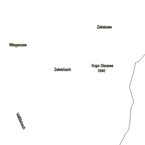
Fluss-Beschriftungen für die Topographische Karte Vorarlbergs
Dieser Layer besteht aus Beschriftungen für die Flüsse Vorarlbergs.
Datenquelle: topo_text_fluesse.shp
Simple
- Date (Creation)
- 2009-11-18
- Date (Revision)
- 2019-07-08T12:00:00
- Identifier
- AT.0025.07.00 / f4473d25-a22c-42aa-b9e5-49d88e6b20d0
Point of contact
Vorarlberg, Amt d. LReg., Abteilung VIIa - Raumplanung
+43 (0) 5574 / 511-927195
https://vorarlberg.at/-/raumplanung-und-baurecht
Landhaus
,
Bregenz
,
6901
,
Austria
+43 (0) 5574/511-27105
+43 (0) 5574 / 511-927195
https://vorarlberg.at/-/raumplanung-und-baurecht
Custodian
Vorarlberg, Amt d. LReg., Abteilung VIIa - Raumplanung
+43 (0) 5574 / 511-927195
https://vorarlberg.at/-/raumplanung-und-baurecht
Landhaus
,
Bregenz
,
6901
,
Austria
+43 (0) 5574/511-27105
+43 (0) 5574 / 511-927195
https://vorarlberg.at/-/raumplanung-und-baurecht
Publisher
Vorarlberg, Landesamt für Vermessung und Geoinformation, Abteilung Geoinformation
+43 (0) 5522 / 754826
https://vorarlberg.at/-/landesamt-fuer-vermessung-und-geoinformation-l-1?article_id=122572
Johannitergasse 6
,
Feldkirch
,
6800
,
Austria
+43 (0) 5522 / 75482
+43 (0) 5522 / 754826
https://vorarlberg.at/-/landesamt-fuer-vermessung-und-geoinformation-l-1?article_id=122572
Owner
Vorarlberg, Amt d. LReg., Abteilung VIIa - Raumplanung
+43 (0) 5574 / 511-927195
https://vorarlberg.at/-/raumplanung-und-baurecht
Landhaus
,
Bregenz
,
6901
,
Austria
+43 (0) 5574/511-27105
+43 (0) 5574 / 511-927195
https://vorarlberg.at/-/raumplanung-und-baurecht
-
VOGIS Thema 1.0.0
-
-
topographische_karten
-
-
VOGIS Unterthema 1.0.0
-
-
topokarte_vogis
-
- Keywords
-
-
karte
-
raumplanung
-
verwaltungseinheiten
-
verkehrsnetze
-
topographie
-
- Access constraints
- Copyright
- Denominator
- 1000
- Metadata language
- Deutsch
- Topic category
-
- Planning cadastre
N
S
E
W
))
- Reference system identifier
- EPSG / MGI / Austria GK West (EPSG:31254) / 7.9
- Distribution format
-
-
ESRI Shapefile
(
1.0
)
-
ESRI Shapefile
(
1.0
)
- OnLine resource
- Geoserver-WMS ( OGC:WMS-http-get-capabilities )
- File identifier
- f4473d25-a22c-42aa-b9e5-49d88e6b20d0 XML
- Metadata language
- Deutsch
- Hierarchy level
- Dataset
- Date stamp
- 2025-04-14T14:59:40
- Metadata standard name
-
ISO19115
- Metadata standard version
-
2003/Cor.1:2006
Custodian
Vorarlberg, Landesamt für Vermessung und Geoinformation, Abteilung Geoinformation
+43 (0) 5522 / 754826
https://vorarlberg.at/-/landesamt-fuer-vermessung-und-geoinformation-l-1?article_id=122572
Johannitergasse 6
,
Feldkirch
,
6800
,
Austria
+43 (0) 5522 / 75482
+43 (0) 5522 / 754826
https://vorarlberg.at/-/landesamt-fuer-vermessung-und-geoinformation-l-1?article_id=122572
Overviews
large_thumbnail
Spatial extent
N
S
E
W
Provided by

Associated resources
Not available