 VoGIS Metadatenkatalog
Topographische Karte 1:50.000 (ÖK 50) (Fremddaten)
Topographische Karte 1:50.000 (ÖK 50), Kartenmaßstab 1:50.000
1 Kanal RGB-Raster-Tif Palette)
Datenquelle:
oek50.tif
Simple
- Date (Creation)
- 2015-07-27
- Date (Revision)
- 2019-07-08T12:00:00
- Unique resource identifier
- 23586aca-47f3-4185-987c-421e5229ae5e
Owner
Bundesamt für Eich- und Vermessungswesen
-
+43 1 21110-992161
https://www.bev.gv.at/public.html
Obere Donaustraße 55
,
Wien
,
1020
,
Austria
+43 1 21110-2160
+43 1 21110-992161
https://www.bev.gv.at/public.html
Point of contact
Vorarlberg, Landesamt für Vermessung und Geoinformation, Abteilung Geoinformation
+43 (0) 5522 / 754826
https://vorarlberg.at/-/landesamt-fuer-vermessung-und-geoinformation-l-1?article_id=122572
Johannitergasse 6
,
Feldkirch
,
6800
,
Austria
+43 (0) 5522 / 75482
+43 (0) 5522 / 754826
https://vorarlberg.at/-/landesamt-fuer-vermessung-und-geoinformation-l-1?article_id=122572
Publisher
Vorarlberg, Landesamt für Vermessung und Geoinformation, Abteilung Geoinformation
+43 (0) 5522 / 754826
https://vorarlberg.at/-/landesamt-fuer-vermessung-und-geoinformation-l-1?article_id=122572
Johannitergasse 6
,
Feldkirch
,
6800
,
Austria
+43 (0) 5522 / 75482
+43 (0) 5522 / 754826
https://vorarlberg.at/-/landesamt-fuer-vermessung-und-geoinformation-l-1?article_id=122572
Custodian
Vorarlberg, Landesamt für Vermessung und Geoinformation, Abteilung Geoinformation
+43 (0) 5522 / 754826
https://vorarlberg.at/-/landesamt-fuer-vermessung-und-geoinformation-l-1?article_id=122572
Johannitergasse 6
,
Feldkirch
,
6800
,
Austria
+43 (0) 5522 / 75482
+43 (0) 5522 / 754826
https://vorarlberg.at/-/landesamt-fuer-vermessung-und-geoinformation-l-1?article_id=122572
- Maintenance and update frequency
- Not planned
-
VOGIS Thema 1.0.0
-
-
topographische_karten
-
-
VOGIS Unterthema 1.0.0
-
-
oek
-
-
GEMET
-
-
karte
-
- Keywords
-
-
topographie
-
- Access constraints
- Copyright
- Use constraints
- otherRestictions
- Spatial representation type
- Grid
Spatial resolution
- Distance
- 2.5 m
- Metadata language
-
ger
- Character set
- UTF8
- Topic category
-
- Planning cadastre
N
S
E
W
))
- Reference system identifier
- EPSG / MGI / Austria GK West (EPSG:31254) / 8.6
- Distribution format
-
-
ECW
(
)
-
ECW
(
)
- OnLine resource
- oek50 ( OGC:WMS-http-get-capabilities )
- Hierarchy level
- Dataset
- Statement
-
Eigene Erfassung / BEV
- File identifier
- 23586aca-47f3-4185-987c-421e5229ae5e XML
- Metadata language
- Deutsch
- Character set
- UTF8
- Hierarchy level
- Dataset
- Date stamp
- 2025-04-14T15:00:16
- Metadata standard name
-
ISO 19115:2003/19139
- Metadata standard version
-
1.0
Point of contact
Vorarlberg, Landesamt für Vermessung und Geoinformation, Abteilung Geoinformation
+43 (0) 5522 / 754826
https://vorarlberg.at/-/landesamt-fuer-vermessung-und-geoinformation-l-1?article_id=122572
Johannitergasse 6
,
Feldkirch
,
6800
,
Austria
+43 (0) 5522 / 75482
+43 (0) 5522 / 754826
https://vorarlberg.at/-/landesamt-fuer-vermessung-und-geoinformation-l-1?article_id=122572
Overviews
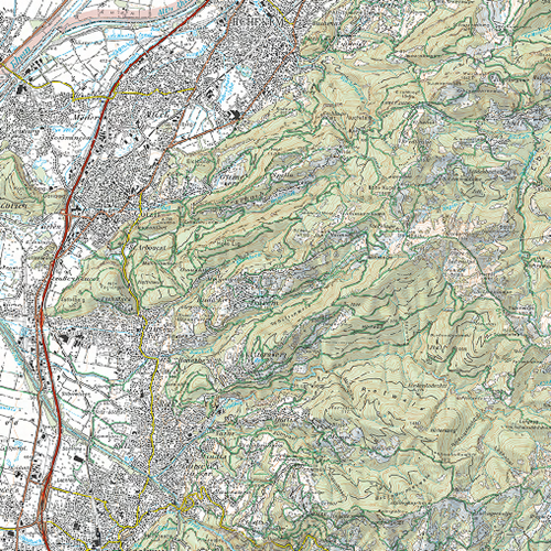
Oek 50
Spatial extent
N
S
E
W
Provided by

Associated resources
Not available