 VoGIS Metadatenkatalog
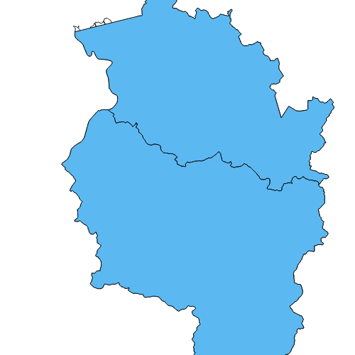
Vermessungsbezirke Vorarlbergs
Grafische Darstellung der Vermessungsbezirke Vorarlbergs, abgeleitet aus den Katastralgemeindegrenzen (kgflaeche.shp).
Wichtige Felder und Datentypen der Attributtabelle:
KBEZ_NAME(TEXT) = Name des Vermessungsbezirks
KBEZ_NR(INT) = Nummer des Vermessungsbezirks
Datenquelle: vermessungsbezirk.shp
Simple
- Date (Creation)
- 2009-11-26
- Date (Revision)
- 2024-07-11T12:28:04
- Identifier
- AT.0025.31.00 / 076a5472-ceb3-4d22-9f39-79d26445b299
- Presentation form
- Digital map
+43 (0) 5522 / 754826
https://vorarlberg.at/-/landesamt-fuer-vermessung-und-geoinformation-l-1?article_id=122572
+43 (0) 5522 / 754826
https://vorarlberg.at/-/landesamt-fuer-vermessung-und-geoinformation-l-1?article_id=122572
+43 (0) 5522 / 754826
https://vorarlberg.at/-/landesamt-fuer-vermessung-und-geoinformation-l-1?article_id=122572
+43 (0) 5522 / 754826
https://vorarlberg.at/-/landesamt-fuer-vermessung-und-geoinformation-l-1?article_id=122572
-
VOGIS Thema 1.0.0
-
-
grenzen
-
-
VOGIS Unterthema 1.0.0
-
-
verwaltungsgrenzen
-
- Keywords
-
-
bezirk
-
grenze
-
verwaltungseinheiten
-
verwaltungsgrenze
-
vermessung
-
- Access constraints
- Copyright
- Denominator
- 5000
- Metadata language
- Deutsch
- Topic category
-
- Planning cadastre
))
- Reference system identifier
- EPSG / MGI / Austria GK West (EPSG:31254) / 7.9
- Distribution format
-
-
ESRI Shapefile
(
1.0
)
-
ESRI Shapefile
(
1.0
)
- OnLine resource
- Geoserver-WMS ( OGC:WMS-http-get-capabilities )
- OnLine resource
- Geoserver-WFS ( OGC:WFS-http-get-capabilities )
- OnLine resource
-
Shapefile-Download
(
WWW:DOWNLOAD-1.0-http--download
)
Achtung !! max. Features = 100.000
- OnLine resource
-
Geopackage-Download
(
WWW:DOWNLOAD-1.0-http--download
)
Achtung !! max. Features = 100.000
- Hierarchy level
- Dataset
- Statement
-
Digitalisierung auf Basis Luftbild und Grenzen des digitalen Katasters
- File identifier
- 076a5472-ceb3-4d22-9f39-79d26445b299 XML
- Metadata language
- Deutsch
- Hierarchy level
- Dataset
- Date stamp
- 2025-04-14T15:00:19
- Metadata standard name
-
ISO19115
- Metadata standard version
-
2003/Cor.1:2006
Overviews
Spatial extent
Provided by
