Urmappe Vorarlberg 1857 (Fremddaten)
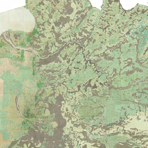
Die Urmappe oder genauer der Franziszeische Kataster von 1857 ist der erste stabile Grundsteuerkataster der Österreich-Ungarischen Monarchie
Die VoGIS-Aufarbeitung der 1940 Blätter für Vorarlberg hat eine Rasterweite von 25cm.
3 Kanal RGB-Raster-ECW
Datenquelle:
um_25cm.ecw
Simple
- Date (Creation)
- 2009-11-13
- Date (Revision)
- 2019-07-08T12:00:00
- Code
- 88df1346-6fdb-49b3-9b3a-1b307230368c
- Point of contact
-
Organisation name Individual name Electronic mail address Role Bundesamt für Eich- und Vermessungswesen
Owner Vorarlberg, Landesamt für Vermessung und Geoinformation, Abteilung Geoinformation
Point of contact Vorarlberg, Landesamt für Vermessung und Geoinformation, Abteilung Geoinformation
Publisher Vorarlberg, Landesamt für Vermessung und Geoinformation, Abteilung Geoinformation
Custodian
- Maintenance and update frequency
- Not planned
-
VOGIS Thema 1.0.0
-
-
grenzen
-
-
VOGIS Unterthema 1.0.0
-
-
urmappe
-
-
GEMET
-
-
kataster
-
karte
-
- Keywords
-
-
urmappe
-
grundsteuer
-
- Access constraints
- Copyright
- Use constraints
- otherRestictions
- Spatial representation type
- Grid
Spatial resolution
- Distance
- 25 cm
- Language
-
ger
- Character set
- UTF8
- Topic category
-
- Planning cadastre
))
- Reference system identifier
- EPSG / MGI / Austria GK West (EPSG:31254) / 8.6
- Distribution format
-
Name Version ECW
Digital transfer options
- Hierarchy level
- Dataset
- Statement
-
Eigene Erfassung / BEV
Metadata
- File identifier
- 88df1346-6fdb-49b3-9b3a-1b307230368c XML
- Metadata language
- Deutsch
- Character set
- UTF8
- Hierarchy level
- Dataset
- Date stamp
- 2026-05-15T11:41:21.837Z
- Metadata standard name
-
ISO 19115:2003/19139
- Metadata standard version
-
1.0
- Metadata author
-
Organisation name Individual name Electronic mail address Role Vorarlberg, Landesamt für Vermessung und Geoinformation, Abteilung Geoinformation
Point of contact
Overviews
Spatial extent
Provided by
