 VoGIS Metadatenkatalog
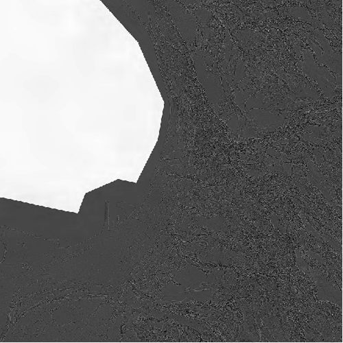
Krümmung des Geländehöhenmodells Vorarlberg 2017 als Graubild, 50cm
Krümmung des Geländehöhenmodells der 3. Laserscanning-Aufnahme Vorarlberg 2017 als Graubild, 50cm Rasterweite
3 Kanal RGB-Raster-ECW
Datenquelle:
ct2017_50cm.ecw
Simple
- Date (Creation)
- 2019-09-10
- Date (Revision)
- 2019-09-10T12:00:00
- Unique resource identifier
- 5d9bc430-6222-4cc7-806d-a960a47a0320
Point of contact
Vorarlberg, Landesamt für Vermessung und Geoinformation, Abteilung Geoinformation
+43 (0) 5522 / 754826
https://vorarlberg.at/-/landesamt-fuer-vermessung-und-geoinformation-l-1?article_id=122572
Johannitergasse 6
,
Feldkirch
,
6800
,
Austria
+43 (0) 5522 / 75482
+43 (0) 5522 / 754826
https://vorarlberg.at/-/landesamt-fuer-vermessung-und-geoinformation-l-1?article_id=122572
Custodian
Vorarlberg, Landesamt für Vermessung und Geoinformation, Abteilung Geoinformation
+43 (0) 5522 / 754826
https://vorarlberg.at/-/landesamt-fuer-vermessung-und-geoinformation-l-1?article_id=122572
Johannitergasse 6
,
Feldkirch
,
6800
,
Austria
+43 (0) 5522 / 75482
+43 (0) 5522 / 754826
https://vorarlberg.at/-/landesamt-fuer-vermessung-und-geoinformation-l-1?article_id=122572
Publisher
Vorarlberg, Landesamt für Vermessung und Geoinformation, Abteilung Geoinformation
+43 (0) 5522 / 754826
https://vorarlberg.at/-/landesamt-fuer-vermessung-und-geoinformation-l-1?article_id=122572
Johannitergasse 6
,
Feldkirch
,
6800
,
Austria
+43 (0) 5522 / 75482
+43 (0) 5522 / 754826
https://vorarlberg.at/-/landesamt-fuer-vermessung-und-geoinformation-l-1?article_id=122572
Owner
Vorarlberg, Landesamt für Vermessung und Geoinformation, Abteilung Geoinformation
+43 (0) 5522 / 754826
https://vorarlberg.at/-/landesamt-fuer-vermessung-und-geoinformation-l-1?article_id=122572
Johannitergasse 6
,
Feldkirch
,
6800
,
Austria
+43 (0) 5522 / 75482
+43 (0) 5522 / 754826
https://vorarlberg.at/-/landesamt-fuer-vermessung-und-geoinformation-l-1?article_id=122572
- Maintenance and update frequency
- Not planned
-
VOGIS Thema 1.0.0
-
-
gelaendemodelle
-
-
VOGIS Unterthema 1.0.0
-
-
kruemmung
-
-
GEMET - INSPIRE themes, version 1.0
-
-
höhe
-
-
GEMET
-
-
digitales geländemodell
-
höhe
-
- Keywords
-
-
laserscanning
-
vorarlberg
-
krümmung
-
- Access constraints
- Copyright
- Use constraints
- otherRestictions
Resource constraints
No information provided.
- Spatial representation type
- Grid
- Distance
- 50 cm
- Metadata language
-
ger
- Character set
- UTF8
- Topic category
-
- Elevation
N
S
E
W
))
- Reference system identifier
- EPSG / MGI / Austria GK West (EPSG:31254) / 8.6
- Distribution format
-
-
ECW
(
-
)
-
ECW
(
-
)
- Statement
-
Eigene Erfassung
- File identifier
- 5d9bc430-6222-4cc7-806d-a960a47a0320 XML
- Metadata language
- Deutsch
- Character set
- UTF8
- Hierarchy level
- Dataset
- Date stamp
- 2025-04-14T14:59:17
- Metadata standard name
-
ISO 19115:2003/19139
- Metadata standard version
-
1.0
Point of contact
Vorarlberg, Landesamt für Vermessung und Geoinformation, Abteilung Geoinformation
+43 (0) 5522 / 754826
https://vorarlberg.at/-/landesamt-fuer-vermessung-und-geoinformation-l-1?article_id=122572
Johannitergasse 6
,
Feldkirch
,
6800
,
Austria
+43 (0) 5522 / 75482
+43 (0) 5522 / 754826
https://vorarlberg.at/-/landesamt-fuer-vermessung-und-geoinformation-l-1?article_id=122572
Overviews
Krümmung des Geländemodells 2017
Spatial extent
N
S
E
W
Provided by

Associated resources
Not available