 VoGIS Metadatenkatalog
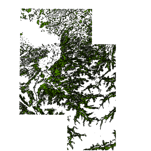
Waldfläche aus der ÖK50 Vorarlberg (Fremddaten)
Waldflächenebene der ÖK 1:50.000 Stand 2004
Wichtige Felder und Datentypen der Attributtabelle:
Name, Typ, Typname, Länge
WALD, int, Integer, 1
Datenquelle: waldflaeche_oek.shp
Simple
- Date (Creation)
- 2010-01-08
- Date (Revision)
- 2023-03-08T12:00:00
- Identifier
- AT.0025.31.00 / b186bcb3-7d14-4db0-ba9c-2d58c66ac8ef
- Presentation form
- Digital map
- Status
- Historical archive
Point of contact
Vorarlberg, Landesamt für Vermessung und Geoinformation, Abteilung Geoinformation
+43 (0) 5522 / 754826
https://vorarlberg.at/-/landesamt-fuer-vermessung-und-geoinformation-l-1?article_id=122572
Johannitergasse 6
,
Feldkirch
,
6800
,
Austria
+43 (0) 5522 / 75482
+43 (0) 5522 / 754826
https://vorarlberg.at/-/landesamt-fuer-vermessung-und-geoinformation-l-1?article_id=122572
Custodian
Vorarlberg, Landesamt für Vermessung und Geoinformation, Abteilung Geoinformation
+43 (0) 5522 / 754826
https://vorarlberg.at/-/landesamt-fuer-vermessung-und-geoinformation-l-1?article_id=122572
Johannitergasse 6
,
Feldkirch
,
6800
,
Austria
+43 (0) 5522 / 75482
+43 (0) 5522 / 754826
https://vorarlberg.at/-/landesamt-fuer-vermessung-und-geoinformation-l-1?article_id=122572
Publisher
Vorarlberg, Landesamt für Vermessung und Geoinformation, Abteilung Geoinformation
+43 (0) 5522 / 754826
https://vorarlberg.at/-/landesamt-fuer-vermessung-und-geoinformation-l-1?article_id=122572
Johannitergasse 6
,
Feldkirch
,
6800
,
Austria
+43 (0) 5522 / 75482
+43 (0) 5522 / 754826
https://vorarlberg.at/-/landesamt-fuer-vermessung-und-geoinformation-l-1?article_id=122572
Owner
Bundesamt für Eich- und Vermessungswesen
-
+43 1 21110-992161
https://www.bev.gv.at/public.html
Obere Donaustraße 55
,
Wien
,
1020
,
Austria
+43 1 21110-2160
+43 1 21110-992161
https://www.bev.gv.at/public.html
-
VOGIS Thema 1.0.0
-
-
forstwesen
-
-
VOGIS Unterthema 1.0.0
-
-
wald
-
- Keywords
-
-
bodenbedeckung
-
karte
-
wald
-
waldbestand
-
- Access constraints
- Copyright
- Denominator
- 5000
- Metadata language
- Deutsch
- Topic category
-
- Imagery base maps earth cover
N
S
E
W
))
- Reference system identifier
- EPSG / MGI / Austria GK West (EPSG:31254) / 7.9
- Distribution format
-
-
ESRI Shapefile
(
1.0
)
-
ESRI Shapefile
(
1.0
)
- OnLine resource
- Geoserver-WMS ( OGC:WMS-http-get-capabilities )
- OnLine resource
- Geoserver-WFS ( OGC:WFS-http-get-capabilities )
- OnLine resource
-
Shapefile-Download
(
WWW:DOWNLOAD-1.0-http--download
)
Achtung !! max. Features = 100.000
- File identifier
- b186bcb3-7d14-4db0-ba9c-2d58c66ac8ef XML
- Metadata language
- Deutsch
- Hierarchy level
- Dataset
- Date stamp
- 2025-04-14T14:42:22
- Metadata standard name
-
ISO19115
- Metadata standard version
-
2003/Cor.1:2006
Overviews
large_thumbnail
Spatial extent
N
S
E
W
Provided by

Associated resources
Not available