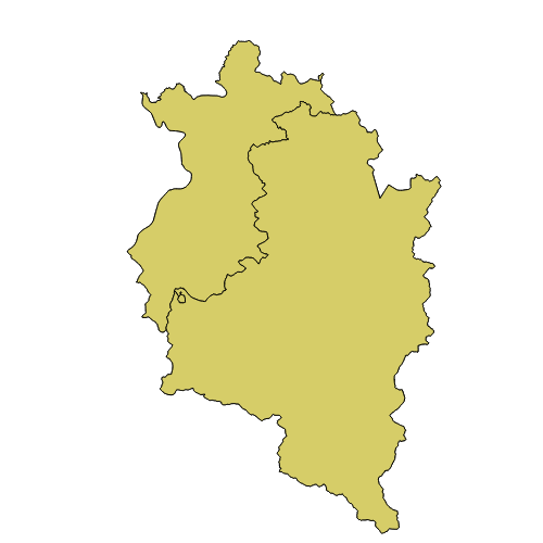
NUTS3 Grenzen Vorarlberg
NUTS ist die Abkürzung für „Nomenclature des unités territoriales statistiques“. Dies ist eine hierarchisch gegliederte Systematik der Gebietseinheiten für die Statistik, die das Gebiet der EU auf 3 Ebenen in Gebietseinheiten unterteilt. Sie ist die Grundlage zur regionalen statistischen Auswertung und regionalen Förderung innerhalb der EU. In der NUTS3 Ebene befinden sich Gruppen von Bezirken, d.h. es sind mehrere Gemeinden zusammengefasst.
Wichtige Felder und Datentypen der Attributtabelle:
NUTS3 (integer) Nummer des Nuts3 Gebietes Bps: 341; 3 steht für Westösterreich, 4 für Vorarlberg, 1 für Bludenz-Bregenzerwald
NUTS_NAME (integer)
Datenquelle: nuts3.shp
Simple
- Date (Creation)
- 2011-05-24
- Date (Revision)
- 2025-02-17T12:00:00
- Citation identifier
- AT.0025.31.00 / a284cf8f-9241-4e1d-9d91-dd10bce8480b
- Presentation form
- Digital map
- Point of contact
-
Organisation name Individual name Electronic mail address Role Vorarlberg, Landesamt für Vermessung und Geoinformation, Abteilung Geoinformation
Point of contact Vorarlberg, Landesamt für Vermessung und Geoinformation, Abteilung Geoinformation
Custodian Vorarlberg, Landesamt für Vermessung und Geoinformation, Abteilung Geoinformation
Publisher Vorarlberg, Landesamt für Vermessung und Geoinformation, Abteilung Geoinformation
Owner
-
VOGIS Thema 1.0.0
-
-
grenzen
-
-
VOGIS Unterthema 1.0.0
-
-
verwaltungsgrenzen
-
- Keywords
-
-
verwaltungsgrenze
-
grenze
-
statistik
-
verwaltungseinheiten
-
- Access constraints
- Copyright
- Denominator
- 5000
- Language
- Deutsch
- Topic category
-
- Planning cadastre
))
- Reference system identifier
- EPSG / MGI / Austria GK West (EPSG:31254) / 7.9
- Distribution format
-
Name Version ESRI Shapefile
1.0
Digital transfer options
- OnLine resource
-
Protocol Linkage Name OGC:WMS-http-get-capabilities
https://vogis.cnv.at/geoserver/vogis/nuts3/wms?service=wms&request=Getcapabilities Geoserver-WMS
OGC:WFS-http-get-capabilities
https://vogis.cnv.at/geoserver/vogis/nuts3/wfs?service=wfs&request=Getcapabilities Geoserver-WFS
WWW:DOWNLOAD-1.0-http--download
https://vogis.cnv.at/geoserver/vogis/nuts3/ows?service=WFS&version=1.0.0&request=GetFeature&typeName=nuts3&maxFeatures=100000&outputFormat=SHAPE-ZIP Shapefile-Download
WWW:DOWNLOAD-1.0-http--download
https://vogis.cnv.at/geoserver/vogis/nuts3/ows?service=WFS&version=1.0.0&request=GetFeature&typeName=nuts3&maxFeatures=100000&outputFormat=gpkg Geopackage-Download
- Hierarchy level
- Dataset
- Statement
-
Digitalisierung auf Basis Luftbild und Grenzen des digitalen Katasters
Metadata
- File identifier
- a284cf8f-9241-4e1d-9d91-dd10bce8480b XML
- Metadata language
- Deutsch
- Hierarchy level
- Dataset
- Date stamp
- 2025-12-17T10:14:36.256Z
- Metadata standard name
-
ISO19115
- Metadata standard version
-
2003/Cor.1:2006
- Metadata author
-
Organisation name Individual name Electronic mail address Role Vorarlberg, Landesamt für Vermessung und Geoinformation, Abteilung Geoinformation
Point of contact
Overviews
Spatial extent
Provided by
