 VoGIS Metadatenkatalog
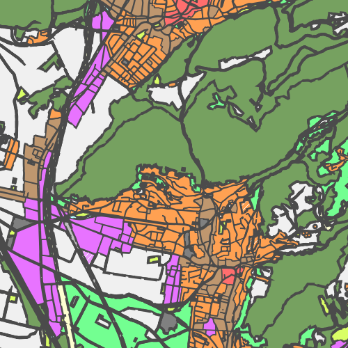
Flächenwidmungsplan Vorarlberg - Flächen
Umfasst alle Grundstücke Vorarlbergs und deren Widmungen und Ersichtlichmachungen.
Ist für INSPIRE gemeldet.
Wichtige Felder und Datentypen der Attributtabelle:
GEMEINDE (string) Gemeindename
STAND (string) offizielles Datum
FLAECHE (double) Fläche des Grundstücks
WI_EM_SIG (string) Widmung - Signatur
WI_EM_TXT (string) Widmung - Text
WI_EM_KN (string) Widmungs- oder Ersichtlichmachungs-Kategorie
WI_EM_UKN (string) Widmungs- oder Ersichtlichmachungs-Unterkategorie
VORBE_WI (string) Art der Vorbehaltsfläche
VORBE_SIG (string) Art der Vorbehaltsfläche - Signatur
FS_TXT (string) Freifläche Sondergebiet - Nähere Beschreibung
LEGENDE (string) Zusatzinformationen zu Grundstück und eventueller Umwidmung
INFO_TXT (string) Zusatzinformationen
Datenquelle: fwp_flaeche.shp
Simple
- Date (Creation)
- 2010-01-19
- Date (Revision)
- 2019-11-15
- Identifier
- https://data.inspire.gv.at/0025/85bd045b-8857-4388-bc07-0fccd5a29eb1
+43 (0) 5574 / 511-927195
https://vorarlberg.at/-/raumplanung-und-baurecht
+43 (0) 5522 / 754826
https://vorarlberg.at/-/landesamt-fuer-vermessung-und-geoinformation-l-1?article_id=122572
+43 (0) 5574 / 511-927195
https://vorarlberg.at/-/raumplanung-und-baurecht
+43 (0) 5574 / 511-927195
https://vorarlberg.at/-/raumplanung-und-baurecht
-
VOGIS Thema 1.0.0
-
-
raumplanung
-
-
VOGIS Unterthema 1.0.0
-
-
flaechenwidmung
-
-
GEMET - INSPIRE themes, version 1.0
-
-
Bodennutzung
-
- Keywords
-
-
flächenwidmung - flächen
-
-
GEMET
-
-
Flächennutzung
-
Flächennutzungsplanung
-
Flächennutzungsplan
-
Flächenwidmung
-
-
Spatial scope
- Access constraints
- Other restrictions
- Use constraints
- Other restrictions
- Other constraints
- Namensnennung 4.0 International (CC BY 4.0)
- Other constraints
-
(c) Land Vorarlberg
- Spatial representation type
- Vector
- Denominator
- 5000
- Metadata language
- Deutsch
- Topic category
-
- Planning cadastre
))
- Reference system identifier
- http://www.opengis.net/def/crs/EPSG/0/31254
- Reference system identifier
- http://www.opengis.net/def/crs/EPSG/0/3035
- Reference system identifier
- http://www.opengis.net/def/crs/EPSG/0/4036
- Distribution format
-
-
ESRI Shapefile
(
-
)
-
ESRI Shapefile
(
-
)
- OnLine resource
-
Darstellungsdienst Flächenwidmungsplan Vorarlberg - Flächen
(
OGC:WMS-http-get-capabilities
)
Darstellungsdienst Flächenwidmungsplan Vorarlberg - Flächen als WMS
- OnLine resource
-
Downloaddienst Flächenwidmungsplan Vorarlberg - Flächen
(
WWW:DOWNLOAD-1.0-http--download
)
Downloaddienst Flächenwidmungsplan Vorarlberg - Flächen als atom-feed
- OnLine resource
- Geoserver-WMS ( OGC:WMS-http-get-capabilities )
- OnLine resource
- Geoserver-WFS ( OGC:WFS-http-get-capabilities )
- OnLine resource
-
Shapefile-Download
(
WWW:DOWNLOAD-1.0-http--download
)
Achtung !! max. Features = 100.000
- OnLine resource
-
Planzeichenverordnung
(
WWW:LINK-1.0-http--link
)
FWP_Legende.pdf
- OnLine resource
-
Geopackage-Download
(
WWW:DOWNLOAD-1.0-http--download
)
Achtung !! max. Features = 100.000
- Hierarchy level
- Dataset
Domain consistency
- Measure identification
- INSPIRE / Conformity_001
Conformance result
- Date (Publication)
- 2010-12-08
- Explanation
-
siehe Referenzdokument (INSPIRE Technical Guidelines)
- Pass
- Yes
- Statement
-
Hersteller: Vorarlberg, Amt d. LReg., Abteilung VIIa - Raumplanung
- File identifier
- 85bd045b-8857-4388-bc07-0fccd5a29eb1 XML
- Metadata language
- Deutsch
- Hierarchy level
- Dataset
- Date stamp
- 2025-04-18T09:42:51
- Metadata standard name
-
ISO19115
- Metadata standard version
-
2003/Cor.1:2006
+43 (0) 5522 / 754826
https://vorarlberg.at/-/landesamt-fuer-vermessung-und-geoinformation-l-1?article_id=122572
Overviews
Spatial extent
Provided by
