 VoGIS Metadatenkatalog
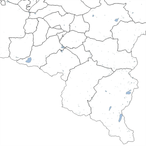
Seen Vorarlberg
Darstellung aller Seen Vorarlbergs inkl. Stauseen
Hydrosphäre, Natürliche Lebensräume, Landschaft, Ökosysteme, Wasser
Datenquelle: seen.shp
Simple
- Date (Creation)
- 2014-01-30
- Date (Revision)
- 2025-02-28T07:29:35
- Identifier
- https://data.inspire.gv.at/0025/636ce9d4-cd81-4cfc-858a-2c415e68fd09
- Status
- On going
+43 (0) 5574 / 511-927495
https://vorarlberg.at/-/viid-abteilung-wasserwirtschaft-unsere-aufgaben
+43 (0) 5574 / 511-927495
https://vorarlberg.at/-/viid-abteilung-wasserwirtschaft-unsere-aufgaben
+43 (0) 5522 / 754826
https://vorarlberg.at/-/landesamt-fuer-vermessung-und-geoinformation-l-1?article_id=122572
+43 (0) 5574 / 511-927495
https://vorarlberg.at/-/viid-abteilung-wasserwirtschaft-unsere-aufgaben
-
VOGIS Thema 1.0.0
-
-
wasser
-
-
VOGIS Unterthema 1.0.0
-
-
seen
-
- Keywords
-
-
seen
-
- Theme
-
-
staubecken
-
binnengewässer
-
hydrosphäre
-
see
-
stehende gewässer
-
-
GEMET - INSPIRE themes, version 1.0
-
-
gewässernetz
-
- Access constraints
- Other restrictions
- Use constraints
- Other restrictions
- Other constraints
- Namensnennung 4.0 International (CC BY 4.0)
- Other constraints
-
(c) Land Vorarlberg
- Spatial representation type
- Vector
- Denominator
- 5000
- Metadata language
- Deutsch
- Topic category
-
- Inland waters
))
- Begin date
- 2013-01-01
- End date
- 2017-03-31
- Reference system identifier
- http://www.opengis.net/def/crs/EPSG/0/31254
- Reference system identifier
- http://www.opengis.net/def/crs/EPSG/0/3035
- Reference system identifier
- http://www.opengis.net/def/crs/EPSG/0/4036
- Distribution format
-
-
ESRI Shapefile
(
-
)
-
ESRI Shapefile
(
-
)
- OnLine resource
- Geoserver-WMS ( OGC:WMS-http-get-capabilities )
- OnLine resource
- Geoserver-WFS ( OGC:WFS-http-get-capabilities )
- OnLine resource
-
Shapefile-Download
(
WWW:DOWNLOAD-1.0-http--download
)
Achtung !! max. Features = 100.000
- OnLine resource
-
Geopackage-Download
(
WWW:DOWNLOAD-1.0-http--download
)
Achtung !! max. Features = 100.000
- Hierarchy level
- Dataset
Domain consistency
- Measure identification
- INSPIRE / Conformity_001
Conformance result
- Date (Publication)
- 2010-12-08
- Explanation
-
siehe Referenzdokument (INSPIRE Technical Guidelines)
- Pass
- No
- Statement
-
Hersteller: Institut für Umwelt und Lebensmittelsicherheit, Abteilung V - Informatik
- File identifier
- 636ce9d4-cd81-4cfc-858a-2c415e68fd09 XML
- Metadata language
- Deutsch
- Hierarchy level
- Dataset
- Date stamp
- 2025-04-14T13:45:15
- Metadata standard name
-
ISO19115
- Metadata standard version
-
2003/Cor.1:2006
+43 (0) 5522 / 754826
https://vorarlberg.at/-/landesamt-fuer-vermessung-und-geoinformation-l-1?article_id=122572
Overviews
Spatial extent
Provided by
