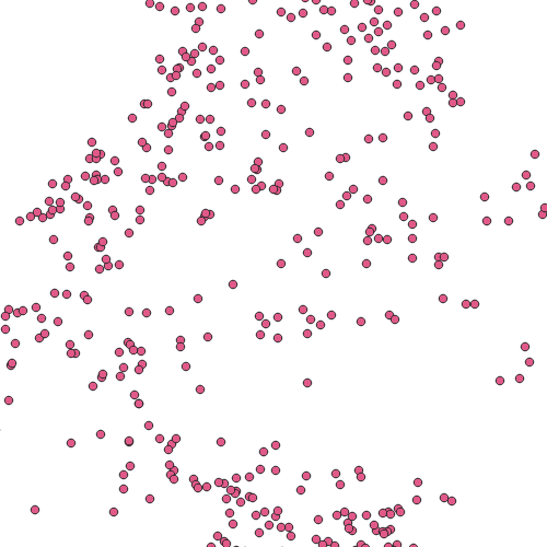
Alte WSKS-Flächen
WSKS - Wildschaden-Kontrollsystem-Vorarlberg
Standorte der WSKS-Flächen ab 2012
Wichtige Felder und Datentypen der Attributtabelle:
Flaechennr, Text, 254, Flächennummer
Waldort, Text, 254, Name des Waldortes
x, Double, 18, X-Koordinate
y, Double, 18, Y-Koordinate
Datenquelle: wsks_ab_2012
Simple
- Date (Creation)
- 2019-12-15
- Date (Revision)
- 2019-12-15T12:00:00
- Identifier
- AT.0025.07.00 / ff67ad33-07ed-4e4e-984b-2393513a2c0e
- Status
- Historical archive
+43 (0) 5574 / 511-925395
https://vorarlberg.at/-/forstwesen-vc
+43 (0) 5574 / 511-925395
https://vorarlberg.at/-/forstwesen-vc
+43 (0) 5522 / 754826
https://vorarlberg.at/-/landesamt-fuer-vermessung-und-geoinformation-l-1?article_id=122572
+43 (0) 5574 / 511-925395
https://vorarlberg.at/-/forstwesen-vc
-
VOGIS-Thema
-
-
Forstwesen
-
-
VOGIS-Unterthema
-
-
Wald
-
-
GEMET - INSPIRE themes, version 1.0
-
-
Umweltüberwachung
-
- Keywords
-
-
GEMET
-
-
Waldschutz
-
Waldschadensinventur
-
Waldschaden
-
- Discipline
-
-
WSKS
-
WWKS
-
Wildschaden
-
- Access constraints
- Copyright
- Denominator
- 5000
- Metadata language
- Deutsch
- Topic category
-
- Farming
))
- Reference system identifier
- EPSG / MGI / Austria GK West (EPSG:31254) / 7.9
- Distribution format
-
-
ESRI Shapefile
(
1.0
)
-
ESRI Shapefile
(
1.0
)
- OnLine resource
- Geoserver-WMS ( OGC:WMS-http-get-capabilities )
- OnLine resource
- Geoserver-WFS ( OGC:WFS-http-get-capabilities )
- OnLine resource
-
Shapefile-Download
(
WWW:DOWNLOAD-1.0-http--download
)
Achtung !! max. Features = 50.000
- Hierarchy level
- Dataset
- Statement
-
Digitalisierung aus Orthophotos und Laserscanning-Höhenmodell
- File identifier
- ff67ad33-07ed-4e4e-984b-2393513a2c0e XML
- Metadata language
- Deutsch
- Hierarchy level
- Dataset
- Date stamp
- 2022-10-20T09:29:07
- Metadata standard name
-
ISO19115
- Metadata standard version
-
2003/Cor.1:2006
+43 (0) 5522 / 754826
https://vorarlberg.at/-/landesamt-fuer-vermessung-und-geoinformation-l-1?article_id=122572
Overviews

Spatial extent
))
Provided by

 VoGIS Metadatenkatalog