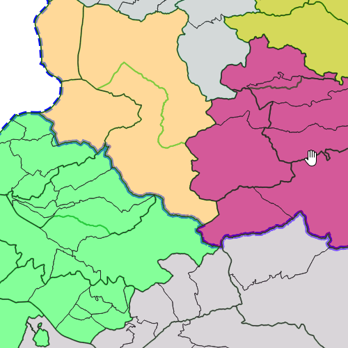
Darstellung der Forstregion Nord und Süd
Darstellung der Forstregionen in Vorarlberg
Vorarlberg wird in die Forstregion Nord und Süd eingeteilt
Wichtige Felder und Datentypen der Attributtabelle (jene, die inhaltliche Informationen enthalten):
Datenquelle: forstregionen.shp
Simple
- Date (Creation)
- 2023-01-10
- Date (Revision)
- 2023-02-20
- Identifier
- AT.0025.07.00 / 2a76f482-a0e3-4afd-b19c-757ec0e03b25
+43 (0) 5522 / 754826
https://vorarlberg.at/-/landesamt-fuer-vermessung-und-geoinformation-l-1?article_id=122572
+43 (0) 5574 / 511-925395
https://vorarlberg.at/-/forstwesen-vc
+43 (0) 5574 / 511-925395
https://vorarlberg.at/-/forstwesen-vc
+43 (0) 5574 / 511-925395
https://vorarlberg.at/-/forstwesen-vc
-
VOGIS-Thema
-
-
Forst
-
-
VOGIS-Unterthema
-
-
Forst
-
Forstregion
-
Waldaufsicht
-
-
GEMET - INSPIRE themes, version 1.0
-
-
Landwirtschaftliche Anlagen und Aquakulturanlagen
-
Verkehrsnetze
-
- Access constraints
- Copyright
- Denominator
- 5000
- Metadata language
- Deutsch
- Topic category
-
- Boundaries
))
- Reference system identifier
- EPSG / MGI / Austria GK West (EPSG:31254) / 7.9
- Distribution format
-
-
ESRI Shapefile
(
1.0
)
-
ESRI Shapefile
(
1.0
)
- OnLine resource
- Geoserver-WMS ( OGC:WMS-http-get-capabilities )
- OnLine resource
- Geoserver-WFS ( OGC:WFS-http-get-capabilities )
- OnLine resource
-
Shapefile-Download
(
WWW:DOWNLOAD-1.0-http--download
)
Achtung !! max. Features = 50.000
- OnLine resource
-
Geopackage-Download
(
WWW:DOWNLOAD-1.0-http--download
)
Achtung !! max. Features = 50.000
- Hierarchy level
- Dataset
- Statement
-
Digitalisierung aus Orthophotos und Laserscanning-Höhenmodell
- File identifier
- d921462d-4f06-45e0-8a21-7c2f2a430c67 XML
- Metadata language
- Deutsch
- Hierarchy level
- Dataset
- Date stamp
- 2024-03-27T14:48:33
- Metadata standard name
-
ISO19115
- Metadata standard version
-
2003/Cor.1:2006
+43 (0) 5522 / 754826
https://vorarlberg.at/-/landesamt-fuer-vermessung-und-geoinformation-l-1?article_id=122572
Overviews

Spatial extent
))
Provided by

 VoGIS Metadatenkatalog