 VoGIS Metadatenkatalog
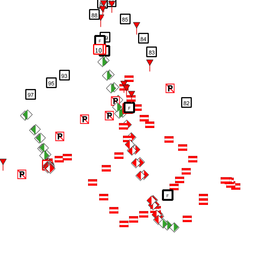
Schifffahrtszeichen am Vorarlberger Bodenseeufer
Punktshapefile mit allen Seezeichen am Vorarlberger Bodenseeufer. Zu fast allen Zeichen gibt es auch ein Foto (Bildnummer in der Attributtabelle)
Wichtige Felder und Datentypen der Attributtabelle:
zeichen1_name, String – Name des Schifffahrtszeichen
zusatzinfo1, Str, String – z.B. Geschwindigkeitsbegrenzung
bemerkung, String – Kommentar
quelle – Vermessung oder Orthofoto inklusive Datum
Datenquelle: bodensee_schifffahrtszeichen.shp
Simple
- Date (Creation)
- 2024-05-08
- Date (Revision)
- 2024-05-24T10:01:24
- Identifier
- AT.0025.31.00 / c5537747-41f6-4dab-b413-e0a54ff15cf5
- Presentation form
- Digital map
- Status
- On going
+43 (0) 5522 / 754826
https://vorarlberg.at/-/landesamt-fuer-vermessung-und-geoinformation-l-1?article_id=122572
+43 (0) 5522 / 754826
https://vorarlberg.at/-/landesamt-fuer-vermessung-und-geoinformation-l-1?article_id=122572
+43 (0) 5522 / 754826
https://vorarlberg.at/-/landesamt-fuer-vermessung-und-geoinformation-l-1?article_id=122572
+43 5574 511 952095
https://vorarlberg.at/-/bhbr
-
VOGIS-Thema
-
-
Wasser
-
-
VOGIS-Unterthema
-
-
Bodensee
-
- Keywords
-
-
Seeschiffahrt
-
Seeverkehr
-
Gewässernetz
-
- Access constraints
- Copyright
- Denominator
- 5000
- Metadata language
- Deutsch
- Topic category
-
- Inland waters
))
- Reference system identifier
- EPSG / MGI / Austria GK West (EPSG:31254) / 7.9
- Distribution format
-
-
ESRI Shapefile
(
1.0
)
-
ESRI Shapefile
(
1.0
)
- OnLine resource
- Geoserver-WMS ( OGC:WMS-http-get-capabilities )
- OnLine resource
- Geoserver-WFS ( OGC:WFS-http-get-capabilities )
- OnLine resource
-
Shapefile-Download
(
WWW:DOWNLOAD-1.0-http--download
)
Achtung !! max. Features = 50.000
- OnLine resource
-
Geopackage-Download
(
WWW:DOWNLOAD-1.0-http--download
)
Achtung !! max. Features = 50.000
- File identifier
- c5537747-41f6-4dab-b413-e0a54ff15cf5 XML
- Metadata language
- Deutsch
- Hierarchy level
- Dataset
- Date stamp
- 2024-09-03T07:56:44
- Metadata standard name
-
ISO19115
- Metadata standard version
-
2003/Cor.1:2006
Overviews
Spatial extent
Provided by
